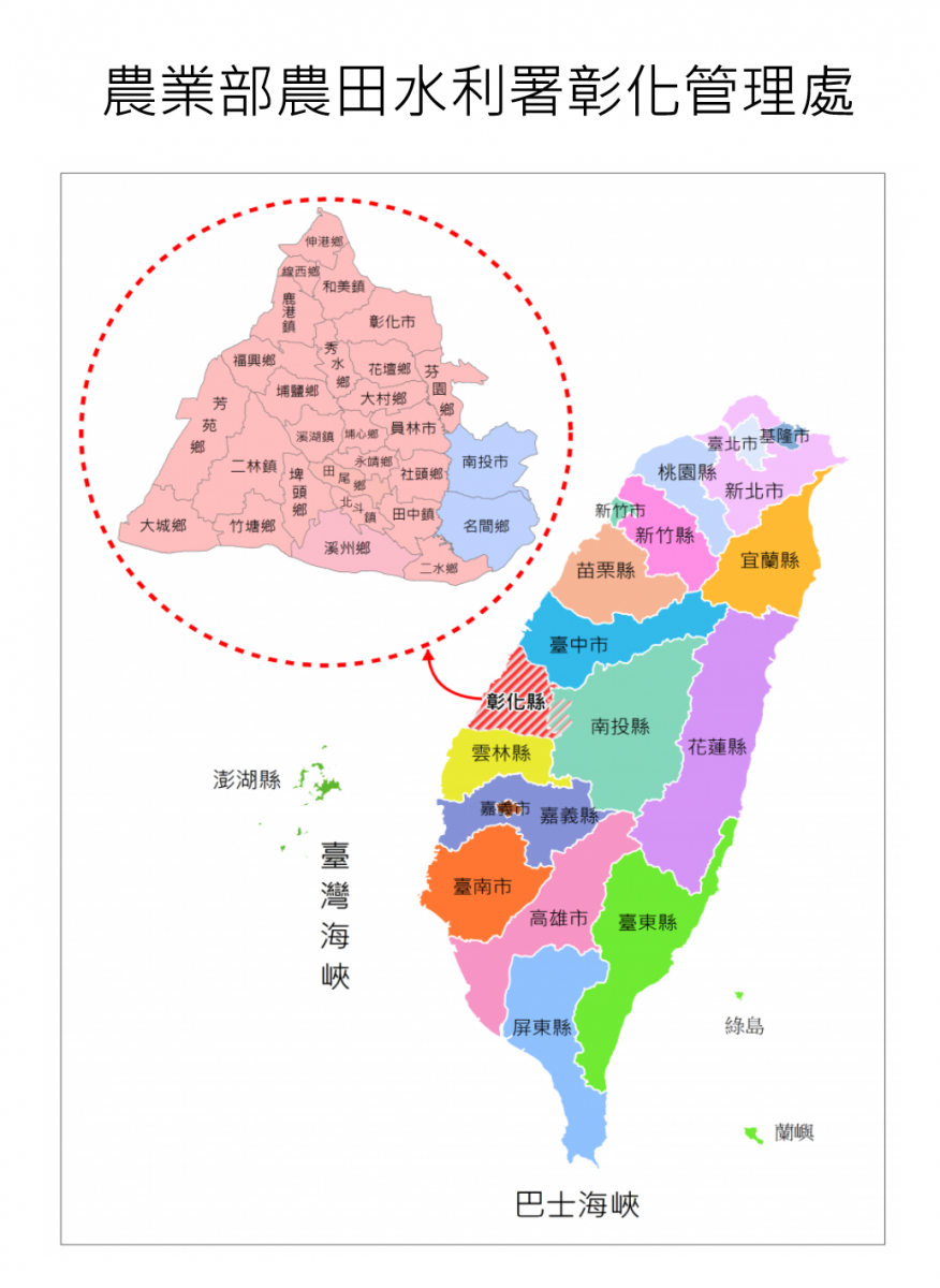
The irrigation area is located between the Wu River and Zhuoshui River and covers 2 cities, 6 townships and 18 towns in Changhua County, Nantou City and Mingjian Township, Nantou County. It starts from Pinglin River and Maoluo River in the east, runs along the Taiwan Strait in the west, to Zhuoshui River in the south, and is bound by Wu River in the north. The terrain slopes from southeast to northwest and is about 43km long from north to south with a maximum width of about 30km from east to west. The terrain is wide in the south and narrow in the north, forming an approximate isosceles triangle shape.
Annual precipitation is about 1,300~2,200mm and although the total amount is abundant it is unevenly distributed in time and location. The annual average temperature is about 22 degrees Celsius, with a subtropical island type climate. There is a northeast monsoon season from October to March every year and the area is often hit by typhoons from July to October.
The Bagua Platform is a Pleistocene laterite-containing terrace accumulation layer, while the Changhua Plain is a modern alluvial layer. Most of the soil is loam or sandy loam, and the land is fertile.
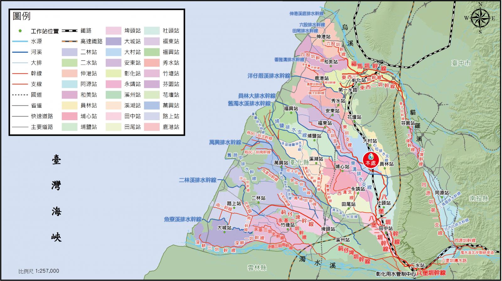
The irrigation water source here is river-type irrigation diverted from Zhuoshui River and Wu River. Due to the lack of reservoir facilities, the water source is unstable, and Zhuoshui River has a high sand content and serious channel siltation, which increases the difficulty of management.
The office’s area of jurisdiction is 62,587 hectares in size, but in 2021 the irrigation area under management was 43,920 hectares, of which the Zhuoshui River system accounted for 87%, including Tongyuan Canal 1,486 hectares, Babao Canal 18,596 hectares, and Cizaipi Canal 18,170 hectares, for a total of 38,252 hectares; the Wu River system accounted for 13%, including Xitoushang Pond and Xitouxia Pond 355 hectares, Dongxi Canal 1,548 hectares, and Fuma Canal 3,765 hectares, for a total of 5,668 hectares.